
Red Alerts are becoming routine across the Himalayas as floods, landslides and glacier bursts rise. Here is what is really happening, and what mountain communities need to survive it.
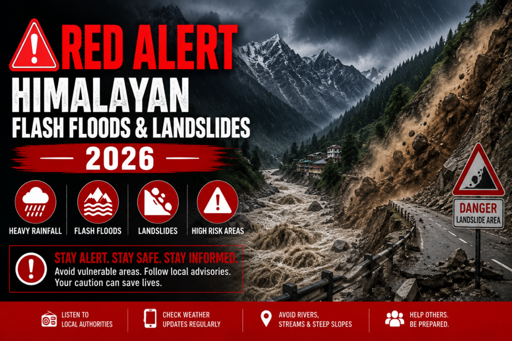
Every 10 days this monsoon, somewhere in the Himalayas, a siren has gone off for a Red Alert. On July 20, 2026, the India Meteorological Department issued fresh Red Alerts for Himachal Pradesh, Uttarakhand, Jammu & Kashmir and Ladakh, warning of rainfall crossing 204.5 mm in a single day in some pockets. These alerts flagged extremely heavy rainfall raising the risk of landslides, flash floods and river swelling across the western Himalayan region.
That is not one bad week. That is the new pattern.
If you live in the hills, or love visiting them, this matters to you directly. This article breaks down why the Himalayan monsoon is turning more violent, what science is telling us about 2026, and what real adaptation looks like for the people who call these mountains home.
Why “Red Alerts” Keep Coming Back
A Red Alert is not just a weather warning. It is the highest level of caution issued by the IMD, meaning authorities expect rainfall heavy enough to shut roads, cut power, and put lives at risk. In July 2026 alone, Red Alerts were issued across Kangra, Mandi, Sirmaur, Chamba and Kullu due to extremely heavy precipitation and heightened flash flood risks, forcing schools and colleges in these districts to shut down.
Ten years ago, this level of alert was rare in the hills. Now it is almost a monthly headline during monsoon season. That change is the real story.
Less Rain, More Danger
Here is the surprising fact that should worry every mountain family. The 2026 forecast for the wider Hindu Kush Himalaya region actually predicted a weaker monsoon overall.
ICIMOD’s HKH Monsoon Outlook 2026, released on June 11, 2026, warned of a hotter, drier Hindu Kush Himalaya region with below-normal rainfall, longer dry spells, and sudden cloudbursts, raising the risk of droughts, flash floods, landslides and glacial lake outburst floods. Less total rain, but far more dangerous rain, packed into short, violent bursts.
Scientists at ICIMOD have been blunt about this. Saswata Sanyal, a disaster risk reduction specialist at ICIMOD, said the biggest misunderstanding is that less seasonal rainfall means lower flood risk. The opposite is closer to the truth this year.
That is exactly what has played out on the ground:
- Intense rain has set off flooding in India’s Arunachal Pradesh.
- Flash floods in Jammu and Kashmir’s Kishtwar district affected the 540 MW Kwar hydroelectric power project and damaged the national highway connecting Kishtwar with Doda.
Experts working directly with mountain communities agree this needs a two-track mindset. Sanyal said this year requires dual preparedness, with communities needing to prepare for prolonged dry spells while staying ready for sudden flash floods, landslides and debris flows. Another ICIMOD water expert added a point worth remembering: mountain communities have long combined scientific forecasts with local knowledge, and that combination matters even more as rainfall turns erratic.
Why a “Cloudburst” Isn’t What It Used to Be
Old textbooks defined a cloudburst strictly, as more than 100 mm of rain falling in a single hour. That definition is outdated now. Modern monsoon patterns are frequently delivering 30 to 50 mm of rain within an hour, and that is already enough to trigger catastrophic flash floods.
This is worth sitting with. A downpour that would once have been considered “heavy but normal” is now capable of wiping out a village road, a bridge, or a home in minutes.
Glacial Lake Outburst Floods
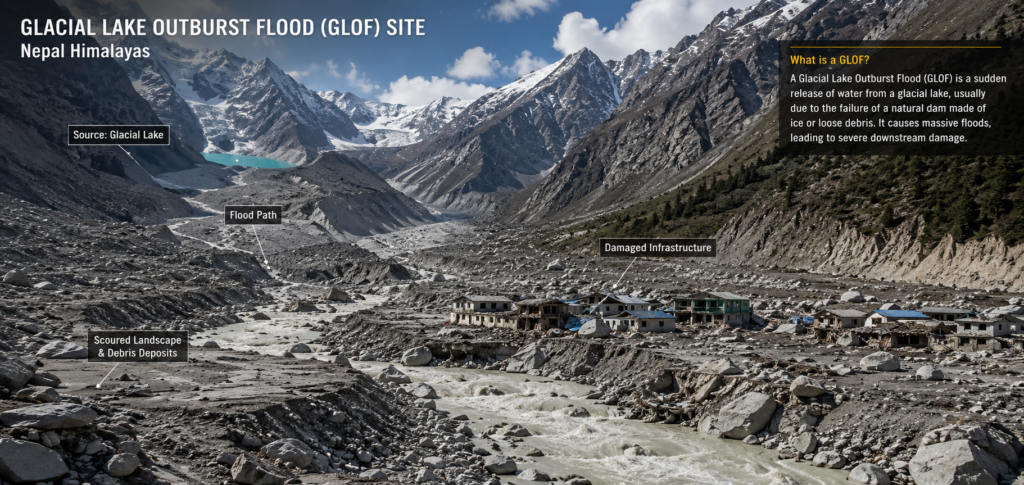
If floods and landslides are the visible danger, glacial lake outburst floods, or GLOFs, are the hidden one. As glaciers melt faster, they leave behind lakes held back by loose rock and ice debris called moraines. When that natural dam gives way, the results are catastrophic.
The clearest recent example is Sikkim’s South Lhonak Lake disaster.
On the night of October 3-4, 2023, a huge chunk of unstable moraine and ice collapsed into South Lhonak Lake in north Sikkim. A landslide of roughly 14.7 million cubic metres crashed into the lake, generating a nearly 20-metre tsunami-like wave that breached the lake’s natural dam and released around 50 million cubic metres of water. The flood then tore through roughly 270 million cubic metres of sediment downstream, wrecking hydropower stations along the Teesta River.
The human cost was severe. The disaster killed more than 92 people across Sikkim and West Bengal, and destroyed 15 bridges along with a major hydroelectric dam.
What makes this event a warning for the whole Himalayan belt is how it built up over decades, not overnight. Satellite records going back to 1962 show that the South Lhonak glacier steadily thinned and retreated, while its lake grew twelvefold in size, from 0.11 square kilometres to 1.4 square kilometres, by 2023. That is climate change working in slow motion, until it suddenly wasn’t slow at all.
This is not a Sikkim-only problem. Researchers estimate 15 million people worldwide live in the path of a possible GLOF, with the Himalayan belt among the highest-risk zones on Earth, alongside parts of Pakistan, Nepal, China and Peru.
Watch this to understand it visually:
It’s Not Just Nature. Bad Construction Is Making It Worse
Here is an uncomfortable truth that gets left out of most weather reports. A good part of the damage from Himalayan floods is man-made, not just rain-made.
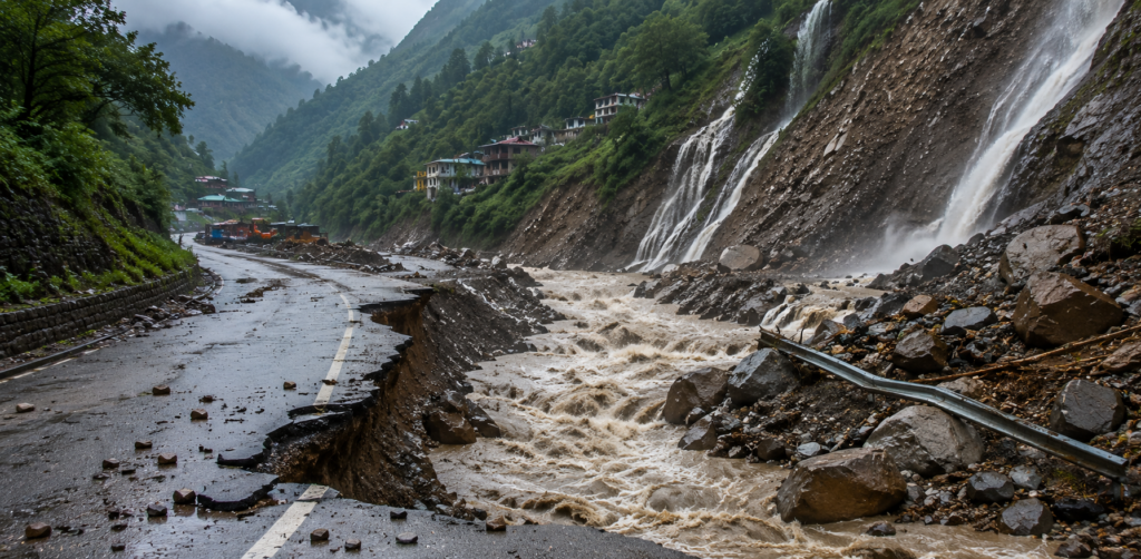
Mountain roads are often cut using generic, vertical hill-cutting methods instead of techniques that respect local rock stability, which weakens nearby slopes and causes chronic landslides that clog river channels with loose debris. On top of this, buildings and roads routinely encroach on active floodplains and natural mountain streams, acting like accidental dams. When the rain comes hard, water builds up behind these blockages until it bursts through in a sudden, destructive wave.
In plain words: we are stacking bad engineering on top of a worsening climate, and mountain families are paying the price twice over.
So, Are Mountain Communities Actually Ready?
Honestly, not yet, in most places. But there are real gaps we can name clearly, and each one has a fix.
Gap 1: Early warning systems are patchy. Sikkim had no dedicated early warning system for South Lhonak Lake despite years of scientific concern about its growing size. Villages downstream had almost no lead time.
Gap 2: Building codes are ignored in the hills. Homes, hotels and roads keep coming up on unstable slopes and old riverbeds, because enforcement is weak and tourism money pulls development toward risky land.
Gap 3: Local knowledge is undervalued. Mountain communities have generations of practical wisdom about which slopes are safe and which streams flood first. This knowledge rarely makes it into official planning.
Gap 4: Infrastructure is built for the old climate, not the new one. Bridges, culverts and drainage systems sized for “normal” rainfall of the past cannot handle today’s cloudburst-style downpours.
What Real Adaptation Looks Like
This is the part that matters most, what can actually be done, starting now.
- Install and maintain automated glacial lake monitoring in high-risk lakes across Himachal Pradesh, Uttarakhand, Sikkim and Ladakh, with sirens and mobile alerts reaching the last village, not just district headquarters.
- Enforce slope-sensitive construction rules, so hill-cutting for roads and buildings uses methods suited to local rock type, not one-size-fits-all blasting.
- Keep floodplains and natural nallahs (streams) free of construction, so water has somewhere to go during a cloudburst instead of backing up behind buildings.
- Fund community-level disaster drills, the way schools do fire drills, so people know evacuation routes before the emergency, not during it.
- Combine scientific forecasting with local seasonal knowledge, since elders and farmers often notice early warning signs, like unusual stream colour or animal behaviour, that instruments miss.
- Rebuild critical infrastructure, like hydropower stations and highways, above flood-tested levels, not at the minimum standard that was “good enough” a decade ago.
None of this is expensive compared to the cost of rebuilding after disaster. The Sikkim flood alone destroyed a major hydropower plant and over a thousand homes. Prevention is cheaper than recovery, every single time.
Voices From the Ground
Founder Nikhil Raj Sharma, who has spent years working on grassroots resilience across the Indian Himalayan Region, has consistently made one point in his public writing: real solutions come from listening to the people already living with the risk, not from policy written far away from the mountains. In past commentary, he has noted that “the real innovation in the Himalayas is not happening in policy meetings in Kathmandu or Delhi. It is happening in classrooms with no electricity, run by teachers who stayed when they could have left.”
The same spirit applies directly to climate resilience. Communities that have survived floods, ice ages and isolation for generations are not helpless, they are underused as a resource. Any adaptation plan that skips their knowledge is starting from a weaker position than it needs to.
What This Means for You, Right Now
If you live in a Himalayan state, or are travelling there this monsoon:
- Check the IMD Red Alert status for your district before travelling on hill roads.
- Avoid building or renting property directly next to streams, nallahs, or on freshly cut slopes.
- Save your local disaster management authority’s emergency number, not just the general helpline.
- If you notice a stream suddenly turning muddy, rising fast, or making unusual sounds upstream, treat it as an early warning, not a coincidence.
Small habits like these have already saved lives during past cloudbursts in Himachal and Uttarakhand.
A Question Worth Sitting With
The Himalayas are not becoming more dangerous because nature turned against us. They are becoming more dangerous because a warming planet is meeting decades of construction choices that ignored the mountains’ own rules. That combination is what turns a rainy week into a Red Alert, and a Red Alert into a tragedy.
Have you or your family lived through a flash flood, landslide, or a Red Alert shutdown in the hills? What helped you stay safe, and what do you wish someone had warned you about earlier? Share your story in the comments below, it could genuinely help another family prepare better for the next monsoon.
References:-
- India Meteorological Department (IMD) — Red Alert bulletins for Himachal Pradesh, Uttarakhand, J&K and Ladakh, July 20, 2026, via Down To Earth
- Sikkim State Disaster Management Authority (SSDMA) — official casualty and damage figures for the 2023 Sikkim floods, via News On Air
- Sattar, A. et al., “The Sikkim flood of October 2023: Drivers, causes, and impacts of a multihazard cascade,” Science, 2024
- “Sequence of events that led to the South Lhonak lake outburst flood in Sikkim, India,” Scientific Reports (Nature)
- “Glacier collapse and moraine failure caused Sikkim’s deadly 2023 lake flood,” Nature
- Wikipedia — “Glacial lake outburst flood” (global risk estimate of 15 million people)
- Wikipedia — “2023 Sikkim flash floods“
- Wikipedia — “2023 Himalayan floods” (Uttarakhand/Himachal August 2023 event)
- ICIMOD Press Release — “Erratic monsoon and rising temperatures heighten flash flood risk across the Hindu Kush Himalaya,” July 7, 2026
- Down To Earth — “Hotter, drier Hindu Kush Himalaya monsoon likely in 2026, ICIMOD warns of dual threat of droughts and flash floods,” June 11, 2026
- Down To Earth — “Enhanced flash flood risks in Hindu Kush Himalaya due to erratic monsoon and high temperatures — ICIMOD“
- Outlook India — “HKH Region Faces Twin Threat Of Droughts, Flash Floods Despite Weaker Monsoon“
- Ground Report — “Erratic Monsoon, Record Heat: Why Flash Flood Risk Is Rising Across Himalayas“
- Adaptation at Altitude — “The 2023 South Lhonak Glacial Lake Outburst Flood: Insights, lessons and recommendations“
- Mongabay India — “No early warning system and insufficient dam safety turned Sikkim flood deadly“
- Daily Excelsior — “Climate drivers of Himalayan flash floods” (hill-cutting, Kishtwar/Chashoti flood context)
- College Simplified — “Himachal Pradesh School Holidays Rainfall Analysis: 2026 Climate & Academic Impact“
- “Glacial Lake Outburst Flood” — explainer
- “How a burst glacial lake caused Sikkim flood & what’s GLOF?“
Related reading and resources:
- ICIMOD Press Release: “Erratic monsoon and rising temperatures heighten flash flood risk across the Hindu Kush Himalaya”
- Down To Earth: “Hotter, drier Hindu Kush Himalaya monsoon likely in 2026”
- Video: Glacial Lake Outburst Flood Explained
- Video: How the Sikkim GLOF happened
- “Himalayan Monsoon Crisis: Why Less Rain Is Triggering 5x More Floods and Landslides“
Disclaimer: The content and images published in this article are provided for general informational and educational purposes only. Some images may be generated or enhanced using artificial intelligence (AI) and are intended solely for illustrative use. The views, interpretations, and information expressed do not necessarily reflect the official position of Himalayan Geographic Research Foundation, nor do they constitute professional, legal, medical, or financial advice.
While efforts are made to ensure accuracy, no guarantees are given regarding completeness or reliability. Readers are encouraged to independently verify information and use their own judgment. By reading this article, you acknowledge that any reliance on the content is at your own risk, and Himalayan Geographic Research Foundation assumes no responsibility or liability for disagreements, interpretations, or outcomes arising from its use. If you do not agree with these terms, you are advised to discontinue reading.