
Himalayan mountain trails were the secret highways of Asia. Learn 7 surprising truths about salt routes, pilgrims, hidden villages, shared ideas, road damage and the fight to revive these ancient paths.
One Changthangi goat gives a family only 200 to 300 grams of raw pashmina in a year, yet that small harvest once helped run trade across Asia. One goat gives a family only 200 to 300 grams of raw pashmina each year. Today you scroll past a shawl in seconds. Long ago, the same fibre walked for weeks on yak and pony backs. Himalayan mountain trails carried it, and they carried far more than wool.
These trails were the expressways of their age, built with footsteps instead of concrete. Salt, tea, books, gods and marriages all moved along them. Then roads arrived, borders closed, and many of these paths went quiet. Some are waking up again this year.
This article follows 7 key ideas, from the first footpaths to the fight to bring them back. Along the way, you will meet mule drivers, monks, salt traders and a town now called a ghost town. Let us start with a simple question: how did people cross the Himalayas before highways?
1. Before Roads, There Were Trails
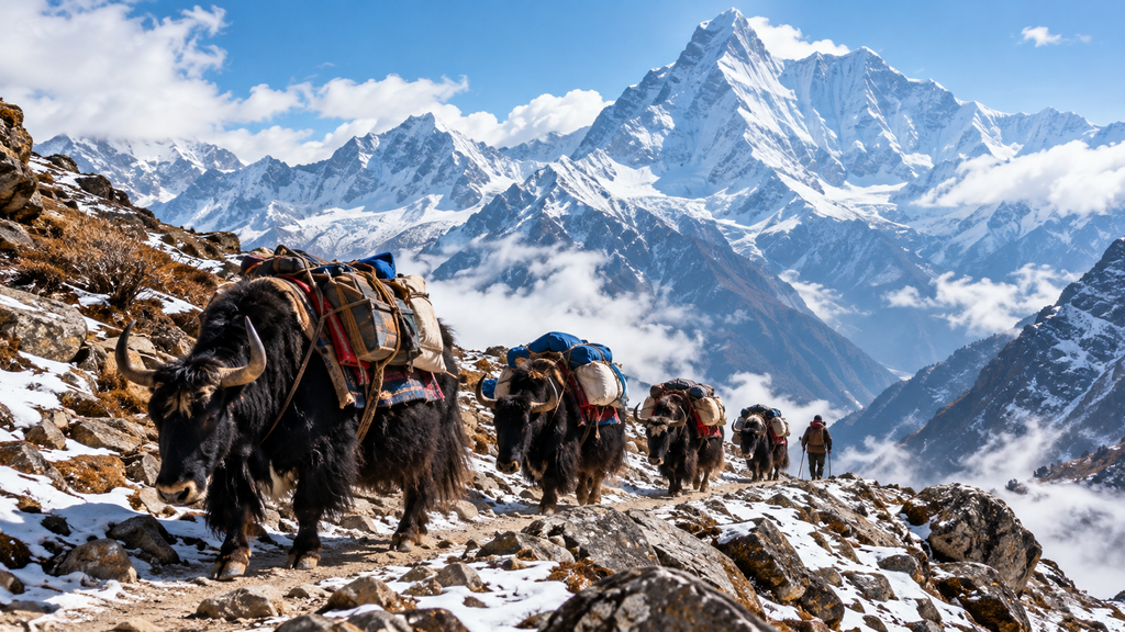
Imagine a world with no tarmac, no trucks and no bridges you can trust. People crossed the mountains on foot, with yaks, ponies and mules carrying the load. Yak and pony caravans brought pashmina from Tibet, and turquoise, coral and silver from Yarkand and Kashgar. Every trader planned around snow, rivers and the calendar.
Passes mattered more than anything. A pass is the lowest safe gap in a mountain wall, and people guarded the knowledge of when to use it. Nathu La and Jelep La worked as a pair, because Jelep La stayed open in all seasons. If snow shut one door, caravans used the other.
Nature also tested travellers. In one account of a Tibet journey, strong storms had washed out bridges on the regular route, so the writer crossed by a high pass instead. That is the old rule of the mountains: the trail you plan is never the trail you walk.
Even today, porters carry goods in places where roads stop. A trail is a road that listens to the mountain. Keep that line in mind, because the rest of this story depends on it.
2. The Ancient Salt Routes
Salt sounds boring until you realise people cannot live without it. The mountains had it in one place and lacked grain, and the plains had grain but little salt. That gap created the trails.
Nepal: salt for rice
The Tibet–Nepal salt trade shows the idea clearly. Tibet had plenty of salt but little rice, while rice was plentiful in southern Nepal and salt was scarce. The Kali Gandaki gorge became a focus of this trade, and towns like Dana and Tukuche served as stops.
In Dolpo, caravans still follow this rhythm. One video from Tinje village shows villagers heading to a Tibetan market that stays open about 15 to 20 days. They carry goods that must cover their needs for a whole year.
Bhutan: rice, paper and tea
Bhutan took part too. Its traders carried goods to fairs across the border. Bhutanese traders took tobacco, English cloth, rice, paper and indigo to Tibet, and came back with Chinese tea bricks, gold dust, salt and borax. Yak trains moved all of it over the mountains.
Records show an organised system. Bhutan sent a royal caravan to Lhasa each year, and much of its trade was transit trade, because salt, gold, tea, pearls and corals did not come from Bhutan. In plain words, Bhutan was a middleman between worlds.
India and Tibet: wool, tea and herbs
Further east and west, passes joined India with Tibet. Tibetan salt, borax and wool travelled to Sikkim, and Sikkimese cardamom, rice and Indian dyes went north. Imports through Nathu La also included silk, raw wool, musk pods and medicinal plants.
In Ladakh, tea joined the list. Leh became a major trading town where Ladakhi merchants exchanged prized pashmina wool for Chinese tea bricks. A single bazaar could hold goods from four regions.
A treaty even protected this business. In 1684, the Treaty of Tingmosgang gave Ladakh the exclusive right to trade pashmina wool from Tibet, which led to its prosperity. Trade was never just about markets. It was about agreements, trust and power.
3. Pilgrims of the Himalayas
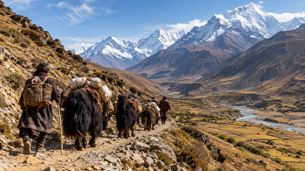
Not everyone walked for profit. Many walked for faith. Buddhist monks, Hindu pilgrims and seekers of every kind used the same passes as the traders. Often, they shared the same campfire.
Monks and scholars
In the 11th century, a Tibetan translator named Rinchen Zangpo walked south to learn from Indian masters. His route into Kashmir ran through Spiti and Kullu, and he met theft, illness and strange customs on the road. He came back with texts, ideas and artists.
Another famous journey came from the other side. The Indian monk Atisha came to Tibet in 1042 at the invitation of the western Tibetan king Yeshe-Ö. A king invited a teacher, and the mountains made the meeting possible.
Hindu pilgrims and sacred lakes
The most famous pilgrim trail today leads to Mount Kailash and Lake Mansarovar. India has organised the yatra through Lipulekh since 1954. Shipki La is set to serve as an additional route, and Himachal officials say its route toward Gartok, Darchen and Mansarovar is shorter on the Tibetan side.
Faith and trade often shared the same ground. At Muktinath in Nepal, researchers describe a trail used by pilgrims and salt traders alike, calling the valleys a capillary network for communication, exchange and veneration. Think of a river system, where small streams join to feed a larger flow.
4. Hidden Villages Along Historic Routes
Here is a secret of the trails. Whole villages grew rich only because a caravan route passed their door. Take away the route, and the village changes forever.
Dana in Nepal shows both the boom and the bust. It sat on the salt and rice route of the Kali Gandaki valley. In 1862, Prime Minister Jang Bahadur Rana introduced a salt-trade monopoly in Thak Khola, which lasted until 1927. Customs posts and traders made the town busy.
Nearby, trade built places of worship. Customs offices were set up at Nhechung, Jomsom, Chhairo and Tukuche to serve the salt trade, and the salt, grain and livestock trade made local Thak communities richer, which helped them found the Chhairo gompa. Wealth became monasteries, schools and homes with painted walls.
India has such places too. The Arghon community of Leh traces its descent from merchants who settled there from Srinagar, Yarkand, Khotan and Kashgar. Their family trees are a living record of the caravan age.
Tiny villages mattered as well. Radni, a hamlet just beyond Shipki La in what is now Tibetan territory, is named as the birthplace of Rinchen Zangpo. A small place by a pass produced one of the great translators in history. Hidden villages hold big stories.
5. The Knowledge Exchange
Goods are easy to count. Ideas are harder, but they changed more lives. Himalayan mountain trails moved languages, art, medicine and building styles, just as fast as they moved wool.
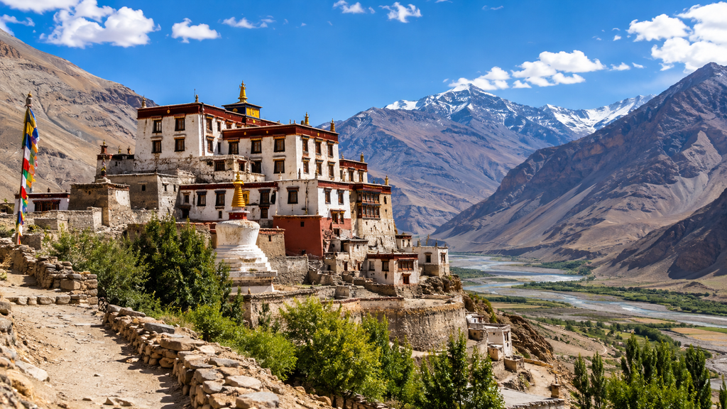
Tabo Monastery in Spiti is the best proof. It was founded in 996 by the translator Rinchen Zangpo on behalf of King Yeshe-Ö of Guge, as a daughter monastery of Tholing in western Tibet. Scholars say it served as a place where Indian pandits learned Tibetan and worked beside Tibetan translators.
Art travelled the same road. Rinchen Zangpo is said to have engaged Kashmiri artists to create wall paintings and sculptures, and Tabo is called the Ajanta of the Himalayas. A fair note: many later attributions to him must be treated with caution, since later tradition added to the story. Still, the paintings and walls at Tabo are real, and they show mixed styles.
Medicine moved too. Rinchen Zangpo received medical teachings in Kashmir and later translated them into Tibetan. Think of a very old exchange programme, run by monks instead of universities.
Everyday life shows the mix as well. In Ladakh, local tradition says early trade deals used a piece of wood called Singchyad, and later traders wrote promissory notes. That is the UPI of the mountains: a simple record that both sides trusted.
6. The Decline of Traditional Trails
Every great trail has a hard chapter. For the Himalayas, several forces hit at once. Borders closed. Prices changed. Then roads arrived.
Politics came first. Nepal–Tibet salt trade stopped abruptly after the political change in Tibet in 1949, and the fall of the Ranas in 1951 ended the power of the Thakali Subba family. In India, Nathu La reopened on 6 July 2006 after being sealed since the 1962 war. Whole generations lost a way of life in between.
Economics came next. When Indian sea salt became available on the Nepal frontier, the price of salt fell, and the old cross-border trade made less economic sense. A trade that lasted for centuries ended because salt became cheap.
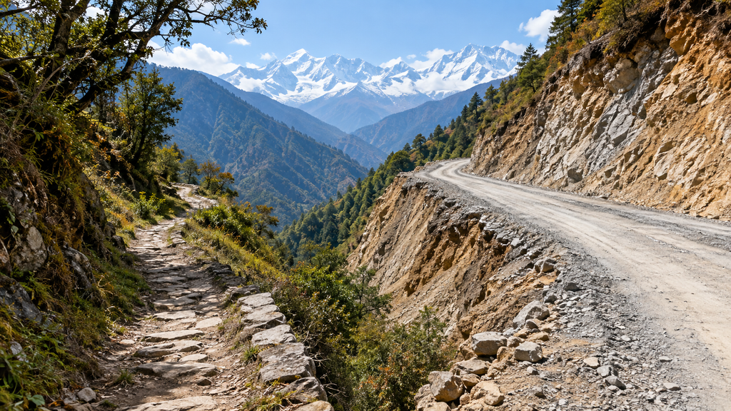
Then came roads, which brought both good and bad. Roads helped medical care, school access and travel. Yet in many places they ran straight along old trails. Nepal Times reported that the Kali Gandaki Highway displaced mule trains, porters and trekkers, and that in the Tsum Valley a road alignment cuts through monasteries and sacred sites.
Look at the numbers on one famous trek. The Annapurna Circuit once took up to 25 days, and it can now be finished in less than a week. More than 60 villages once lay between Besisahar and Beni Bazaar, but only about 10 of them are now regular stops for travellers. The villages are still there. The visitors drive past.
Bhutan sees the same shift. Roads are slowly replacing the ancient footpaths that connect Bhutan’s mountains. Dana became the clearest example of the damage. A Nepali writer visited and called it hollow. The road that now goes up Thak Khola has helped keep Dana a ghost town.
Families paid the price. After closures in Uttarakhand, one woman left the pashmina wool trade and opened homestays for pilgrims. Mountain people adapt, but they should not have to adapt alone.
7. Can These Trails Be Revived?
The honest answer is yes, in parts, and with care. The revival is already starting in three ways.
Trade is reopening
This year brought hopeful news. Border trade resumed through Nathu La and Shipki La on 1 August after a six-year pause, with Nathu La trade running Monday to Thursday until November. Trade through Lipulekh has also restarted, though Nepal objects, saying the pass lies in its territory. This article does not take a side on that border claim.
Heritage trails and trekking
Trekking can protect old routes, if communities lead. In Bhutan, a two-year restoration led by the Bhutan Canada Foundation, with government support, aimed to reopen the Trans Bhutan Trail to trekkers in March 2022. Its survey work identified 400 historic and cultural sites along the route.
Nepal tried a similar plan. A 72-km cultural trail in the Kathmandu valley was restored in 2011 to 2013, and the project also improved local tourism skills and income. Meanwhile, the Great Himalaya Trail programme worked in Humla and Dolpa to help poor mountain communities earn from tourism. The trail has a high route and a lower cultural route.
Experts agree salt routes could join the list. Speakers at a Nepali seminar said heritage trails, including the salt trade route in Dolpa and Mustang, could be developed, and that old trade routes could be revived for poverty reduction and heritage conservation.
Conservation with respect
Revival has a risk. Too many tourists can harm the same places we want to save. So the rules should be simple:
- Let local people own and run the guesthouses, homestays and guiding.
- Keep new roads away from monasteries, sacred sites and the old trail line.
- Protect old walls, mani stones and bridges as heritage, not as photo props.
- Limit group sizes at fragile passes and villages.
- Record oral history now, while elders can still tell it.
One more warning from the research: many heritage trails have already been ruined by ill-planned road construction. Revival works only when the trail comes before the bulldozer.
Comment by Nikhil Raj Sharma, Founder, Himalayan Geographic
Himalayan mountain trails are not just old paths. They are the memory of our mountains. For centuries, traders, monks and pilgrims walked these routes, and with every step they shared salt, wool, prayers and ideas. Many of today’s mountain villages exist because a caravan once stopped there.
At Himalayan Geographic Research Foundation, we believe heritage and development must walk together. Roads bring schools, hospitals and markets, and communities deserve them. But when a road swallows a trail, a monastery wall or a village’s livelihood, we lose something we cannot rebuild.
The way forward is simple. Let local families lead tourism. Protect old trails, bridges and sacred sites. Record the stories of our elders before they fade.
Watch and Learn: YouTube Resources
- The Dolpo Caravan II (villagers prepare for the Tibetan market trip)
- Dolpo Trek (an overview of Dolpo and its salt route)
The Trails Are Still Talking
Himalayan mountain trails were never empty tracks. They joined a herder in Changthang to a weaver in Kashmir, and a monk in Tibet to a scholar in India. They built villages, spread ideas and carried prayers. Roads changed that, but they did not erase it.
The mountains were never a wall. People built paths over them for salt, wool, prayer and learning. Roads are good, but they should not destroy the old paths and villages. Revive the trails slowly, keep the benefits with local families, and protect the stories.
References:
- News Arena, “The Silk Route through the Himalayan passes”
- Outlook Traveller, border trade resumes at Nathu La and Shipki La
- Nathu La (history and trade)
- “Silken Roads of Sikkim”
- Orissa Post, Shipki-La trade revival
- Asia News Network, Lipulekh trade resumes
- Indrastra, “The Lipulekh Pass”
- Ladakh Range and Leh trade routes
- The Himalayan Club, “In the Land of Argans”
- People’s Archive of Rural India, pashmina story
- UNESCO, India’s link with Silk Trade Roads
- Tibet–Nepal salt trade route
- Chhairo gompa (salt-route customs and trade)
- Onlinekhabar, “In Nepal’s ancient salt hub Dana, a walk past yesterday”
- Saul and Waterton, “A Himalayan triptych,” Journal of Heritage Tourism
- Bhutan–Tibet–Bengal trade routes (ICIMOD)
- School for Field Studies, Bhutan trade and footpaths
- Tabo Monastery, historical background
- Himalayan Art Resources, Rinchen Zangpo
- Rangjung Yeshe Wiki, Rinchen Zangpo
- Metropolitan Museum of Art, Buddhist sites in Central Tibet (Atisha)
- Nepali Times, “Walking with the times”
- Himal Press, “Unfriendly infrastructure taking toll on tourism”
- Onlinekhabar, “Annapurna’s Rs 3 billion business at risk”
- UNWTO, “The Great Himalaya Trail in Nepal”
- Kehityslehti, Kathmandu valley cultural trail restoration
- Frommer’s, Trans Bhutan Trail
- Trans Bhutan Trail (Druk Journal)
Disclaimer: The content and images published in this article are provided for general informational and educational purposes only. Some images may be generated or enhanced using artificial intelligence (AI) and are intended solely for illustrative use. The views, interpretations, and information expressed do not necessarily reflect the official position of Himalayan Geographic Research Foundation, nor do they constitute professional, legal, medical, or financial advice.
While efforts are made to ensure accuracy, no guarantees are given regarding completeness or reliability. Readers are encouraged to independently verify information and use their own judgment. By reading this article, you acknowledge that any reliance on the content is at your own risk, and Himalayan Geographic Research Foundation assumes no responsibility or liability for disagreements, interpretations, or outcomes arising from its use. If you do not agree with these terms, you are advised to discontinue reading.