
Brahmaputra floods are more than an Assam problem; they start in the Himalayas. See 7 alarming mountain changes, from glacier melt to mega-dams, fuelling the crisis.
Every monsoon, Assam floods. Every monsoon, the news calls it “another bad year.” But here’s a fact that should stop you mid-scroll: in July 2026, the worst flooding in upper Assam did not even come from the Brahmaputra overflowing. It came from small hill tributaries that nobody was watching closely enough as tributaries in Nagaland and Arunachal Pradesh swelled instead of the main river itself.
That single fact tells you something important. Brahmaputra floods are not just an Assam problem, and they are not just a monsoon problem. They are a Himalayan problem wearing an Assam address. The mountains decide how much water comes down, how fast, and how much mud comes with it. If we want to understand the floods, we have to look up; at the glaciers, the rain clouds, and the crumbling slopes hundreds of kilometres north of Guwahati.
This article walks through 7 alarming changes happening in the Himalayas right now, and why each one is quietly making Assam’s flood problem worse.
1. The Himalayan Origin of the Brahmaputra; A River Born in Tibet
The Brahmaputra doesn’t start in India. It starts high on the Tibetan plateau, near the Angsi Glacier not far from Mount Kailash, where it is called the Yarlung Tsangpo after originating from the Angsi Glacier near Mount Kailash and travelling nearly 1,790 km across southern Tibet.
From there, the river does something dramatic. It makes a huge U-turn around Namcha Barwa peak; geographers call this the Great Bend; before crashing down into India entering India near Mount Namcha Barwa after this great U-turn. Inside India, it is first called the Siang, then the Dihang, and only becomes the “Brahmaputra” once it reaches Assam entering India through Arunachal Pradesh as the Siang or Dihang, flowing through Assam, and entering Bangladesh as the Jamuna after merging with the Teesta.
Why does this matter for floods? Because a river that drops nearly 2,000 metres in a short stretch through a steep gorge picks up enormous energy and force before it reaches flatter ground. Think of it like water rushing down a playground slide versus water on a flat road; by the time it reaches Assam’s plains, the river is carrying speed, volume, and mud picked up across an 1,800 km mountain journey. Mountain systems don’t just feed a river. They set its personality.
2. Extreme Monsoon Rainfall in the Eastern Himalayas
The Eastern Himalayas; Arunachal Pradesh, Bhutan, and the hills around Assam; sit exactly where monsoon clouds slam into mountain walls. When moist air is forced upward quickly, it dumps rain fast. Assam alone gets 2,800 to 3,000 mm of rain a year, with nearly 70% of it packed into the June–September monsoon window.
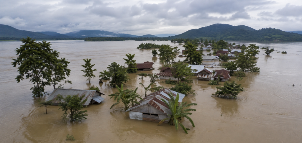
The 2026 floods are the clearest recent example of this. Instead of one big Brahmaputra overflow, extremely heavy rain fell over Nagaland and Arunachal Pradesh, and four south-bank tributaries; the Dikhow, Disang, Janji, and Dhansiri; rose so fast they crossed danger marks before the main river even reached its peak due to excessive upstream rainfall in Nagaland and Arunachal Pradesh causing quick rising of south-bank tributaries.
Interestingly, the India Meteorological Department confirmed this wasn’t a single cloudburst, but a longer spell of extremely heavy rain ruling out a cloudburst and confirming instead a sustained period of extremely heavy rainfall.
More than 7.2 lakh people were affected across ten-plus districts including Sivasagar, Dibrugarh, Dhemaji, and Majuli with more than 7.2 lakh people affected across around 10 districts. By late July, the death toll had climbed close to 50, with officials warning the number could still rise as the number of deaths went up to 47 by 24 July 2026.
3. Glacier Melt and Changing Snow Patterns
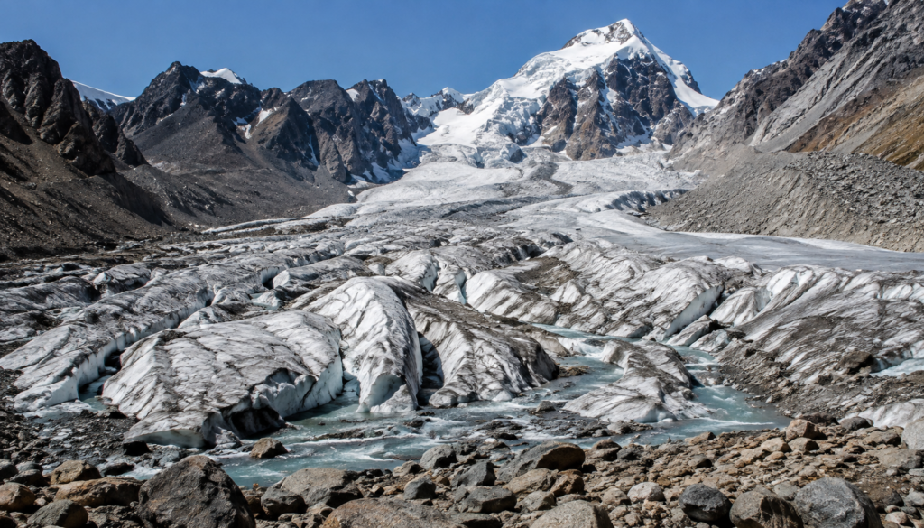
Here’s the number that should worry every Assam resident: the Brahmaputra basin has lost 16% of its glacier area between 1990 and 2020, and the Ganga basin next door has lost 21% with the Ganga and Brahmaputra basins experiencing steeper reductions of 21% and 16% respectively, despite hosting some of the region’s largest glaciers.
It’s not just shrinking; it’s speeding up. ICIMOD, the regional body that tracks Himalayan glaciers, found that ice loss rates have doubled since the year 2000 with glaciers across the Hindu Kush Himalaya melting at an accelerating rate, ice loss rates doubling since 2000, even as they lost 12% of their area between 1990 and 2020. Over the last 50 years, the region has lost ice equal to roughly 24 metres of water depth; picture a six-storey building made entirely of ice, melted away with glaciers losing ice equivalent to nearly 24 metres of water depth in cumulative ice mass from 1973 to 2023.
This actually means more water flowing into the Brahmaputra, not less; melting glaciers are dumping extra water downstream. Scientists call this the “peak water” phase, and they expect it to last until somewhere between 2030 and 2050 with modelling projecting that the Indus, Ganges, and Brahmaputra basins will reach peak water between 2030 and 2050, after which dry-season flows will decline sharply. So the bad news is double-sided: more flood water now, and a water shortage crisis waiting on the other side of that peak.
4. Sediment; The Hidden Driver of Floods
If glacier melt and rain are the “how much water,” sediment is the “why the water has nowhere to go.” The young, actively rising Himalayan mountains erode constantly, and all that broken rock and soil; sand, silt, clay; travels downstream with the river.
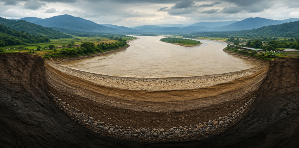
Nearly 45% of the Brahmaputra’s total sediment comes from the Yarlung Tsangpo gorge alone, with another 40% from the wider Himalayan slopes showing that about 45% comes from the Yarlung Tsangpo Gorge and 40% from the Himalaya. Once the river reaches Assam’s flat plains near Pasighat, it slows down and simply cannot carry that much sand anymore as the river’s slope becomes gentler after entering the Assam plains near Pasighat, reducing its ability to carry sand and silt.
So the sediment just… sits there. Layer after layer, year after year. Studies measured the Assam stretch of the riverbed rising by 16 to 21 centimetres in less than a decade during one study period with the suspended load budget indicating overall aggradation of the 607-km Assam reach by about 16 cm, while an alternative channel-measurement method suggested up to 21 cm.
Here’s a simple way to picture it: imagine a bathtub that slowly fills with sand at the bottom. Even if you pour in the same amount of water every year, it spills over the edge faster each time; because the tub itself has gotten shallower. That’s what’s happening to the Brahmaputra’s channel in Assam. And it’s getting worse: climate change could push sediment loads up by 40 to 60% by the end of this century adding to the prospect of increased sediment loads by about 40% by 2075–2100, and by 52–60% by the 2090s.
5. Climate Change and Extreme Weather Events
Beyond rain and melt, two newer threats are entering the picture; cloudbursts and Glacial Lake Outburst Floods, or GLOFs.
A GLOF happens when a lake formed by melting glacier ice suddenly bursts through its natural dam of loose rock and mud. It sounds rare, but it isn’t anymore. In October 2023, the South Lhonak Lake in Sikkim burst, and the resulting flood killed more than 50 people and destroyed a 1,200 MW hydropower dam downstream with the outburst killing 55 people and causing massive infrastructural damage, including the collapse of the 1,200 MW Chungthang Dam.
It wasn’t a total surprise either; the lake had been visibly growing for over 50 years before it finally broke with satellite imagery showing the lake steadily expanding for more than 50 years, adding to the volume of stored meltwater and pressure on its fragile moraine dam.
This isn’t a one-off risk. Roughly 3 million people in India live in areas exposed to GLOF danger, and globally the number could be as high as 15 million with a global study estimating around 3 million people in India exposed to the risk of glacial lake outburst floods, and as many as 15 million people at risk worldwide. As glaciers keep retreating, they keep leaving behind more of these unstable lakes; meaning more GLOF risk for river valleys all across the Himalayas, including the Brahmaputra’s upper catchments.
6. Impact on Communities and Ecosystems
People and farms. Floods don’t just damage homes; they eat away at the land itself. Over the past 50 years, the lower Brahmaputra valley has lost roughly 100 sq km to bank erosion, with the riverbank shifting south by more than 100 metres a year in places with the lower Brahmaputra valley losing approximately 100 sq km to erosion over the past 50 years, with an average annual southward migration of 109.14 metres. Farmers who have worked the same plot for generations sometimes wake up to find part of their field simply isn’t there anymore.
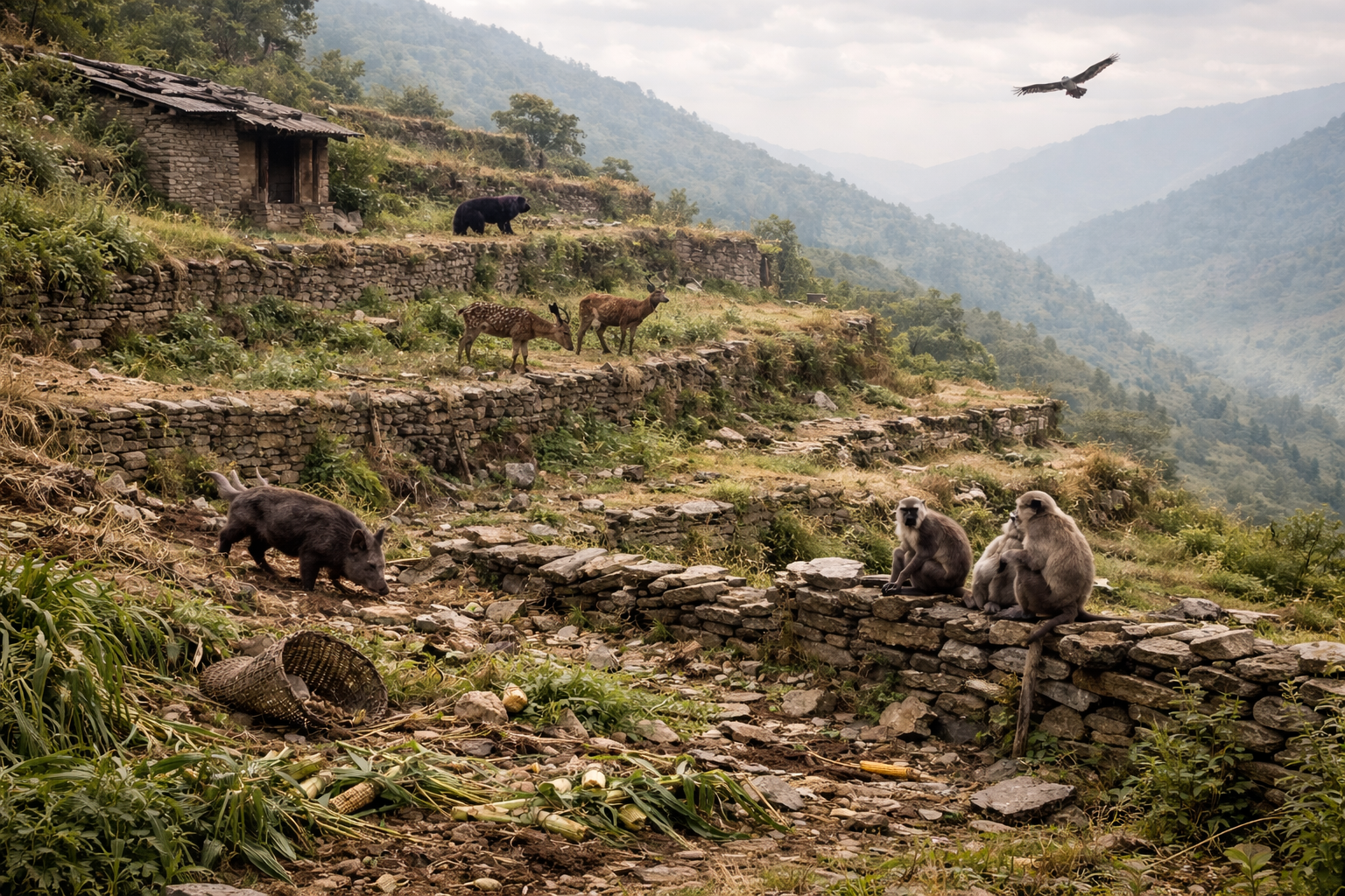
Wildlife and wetlands. Kaziranga National Park, home to the world’s largest population of one-horned rhinos, sits directly in the Brahmaputra’s floodplain. Floods here are a strange mix of harm and healing; they can drown animals, but they also refill wetlands, flush out invasive weeds, and restock fish for the whole ecosystem recharging groundwater systems, removing invasive plant species like water hyacinth from wetlands, and redistributing sediment and nutrients across the landscape. In the 2025 flood season alone, the park recorded 159 wild animal deaths with the park reportedly recording the death of 159 wild animals during the 2025 flood season; a reminder that even a “natural” process has become harder on wildlife as flood patterns grow more erratic.
Bangladesh downstream. The story doesn’t end at the India-Bangladesh border. About 80% of the water flowing through Bangladesh’s rivers is born outside the country with around 80 percent of the water flowing through Bangladesh’s rivers originating outside its borders. When Assam and Meghalaya get hit hard, Bangladesh usually gets hit next, through the Jamuna and a chain of connected rivers as heavy upstream rainfall across Meghalaya, Assam, Tripura, and Mizoram rapidly enters Bangladesh through transboundary rivers including the Brahmaputra.
7. The Future of Flood Management
Early warning systems are improving, but gaps remain. India’s Central Water Commission runs a network of over 1,500 hydrological stations and 360 flood-forecasting points nationwide with the commission operating a network of 1,543 hydrological observation stations and 360 flood forecasting stations, including 201 level-forecast and 159 inflow-forecast stations.
Assam also has its own dedicated system, FLEWS, that issues district-level flood alerts with the North Eastern Space Application Centre issuing Low to Moderate Flood Alerts for multiple districts through its Flood Early Warning System. But many sensor stations sit broken or poorly maintained with many telemetry stations and automated water-level sensors remaining non-functional because of poor maintenance, lack of calibration, and vandalism; a warning system is only as good as its weakest sensor.
Cross-border cooperation is the missing piece. This is where things get genuinely worrying. China and India have no binding treaty for sharing Brahmaputra water data, and China has not shared hydrological data with India since 2022, after an earlier information-sharing MoU expired with China ceasing to share crucial hydrological data with India since 2022, and the Brahmaputra MoU in place since 2002 expiring in June 2023.
China is building a mega hydropower project on the Yarlung Tsangpo with a planned capacity around 60 gigawatts; nearly three times the size of the Three Gorges Dam set to become the world’s largest hydro-power facility, tripling the capacity of China’s Three Gorges Dam. India has responded with its own large hydropower push in the northeast launching a US$77 billion hydropower initiative to construct more than 200 dams, with a planned capacity of 75 gigawatts.
Both governments frame their projects around energy needs and regional development; independent researchers note that without a shared data-and-management framework between all four Brahmaputra countries; China, India, Bhutan, and Bangladesh; flood forecasting downstream will always be working with half the picture.
Sustainable catchment management. Long-term, the fix has to include the mountains themselves; reducing deforestation on steep slopes, protecting the vegetation that holds soil in place, and giving rivers room to spread naturally instead of squeezing them behind embankments that eventually breach anyway.
Nikhil Raj Sharma, Founder, Himalayan Geographic
“People keep asking why Assam floods every year, as if it’s a mystery. It isn’t. The river is telling us, every monsoon, that it needs more room and the mountains upstream are changing faster than our planning is. Until we start treating the Himalayas and the Assam plains as one connected system; not two separate problems; we will keep being surprised by something that isn’t actually a surprise.”
Understanding the 2026 Assam Floods
For a visual breakdown of this year’s flood pattern, this explainer is a useful watch: Assam Floods 2026 Explained – Why Assam Floods Every Year?
The Bottom Line
Assam doesn’t flood because of bad luck. It floods because it sits at the bottom of a mountain system that is warming, melting, eroding, and getting wetter in short, intense bursts; all faster than the plains below can adjust. Fixing the flood problem in Assam means looking 1,800 km upstream, not just at the next embankment.
That means real-time data sharing between all four Brahmaputra countries, faster investment in glacial lake monitoring, and catchment-level care in the mountains, not just riverbank repairs in the plains.
Further Reading & Sources
- ICIMOD, HKH Glacier Outlook 2026 — glacier melt data: himalayan glacier loss report (Down To Earth coverage)
- Central Water Commission flood forecasting network
- The Diplomat, on India-China Brahmaputra water diplomacy
- International Rhino Foundation, on Kaziranga floods and ecology
- Assam Floods 2026 explainer video
Disclaimer: The content and images published in this article are provided for general informational and educational purposes only. Some images may be generated or enhanced using artificial intelligence (AI) and are intended solely for illustrative use. The views, interpretations, and information expressed do not necessarily reflect the official position of Himalayan Geographic Research Foundation, nor do they constitute professional, legal, medical, or financial advice.
While efforts are made to ensure accuracy, no guarantees are given regarding completeness or reliability. Readers are encouraged to independently verify information and use their own judgment. By reading this article, you acknowledge that any reliance on the content is at your own risk, and Himalayan Geographic Research Foundation assumes no responsibility or liability for disagreements, interpretations, or outcomes arising from its use. If you do not agree with these terms, you are advised to discontinue reading.